Signed in as:
filler@godaddy.com

The counties listed share interconnected histories tied to:
• The Kiowa–Comanche–Apache reservation lands
• The opening of the “Big Pasture” in 1901
• Fort Sill (established 1869)
• Cattle trails such as the Western Trail
• Railroad expansion in the late nineteenth century
• Agricultural growth and irrigation projects
• Dust Bowl impacts during the 1930s
While each county maintains a distinct local identity, their histories are regionally connected through geography, migration patterns, and shared institutions.
The region includes former reservation lands of the Kiowa, Comanche, and Apache nations and reflects the continuing presence of tribal communities.
Fort Sill in Comanche County and Altus Air Force Base in Jackson County shaped population growth, infrastructure, and economic development.
Many counties experienced rapid change following the 1901 land opening of the Big Pasture and surrounding lands.
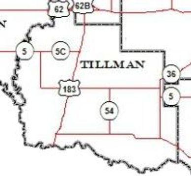
Counties such as Jackson, Tillman, and Cotton developed extensive agricultural production supported by irrigation projects like Lake Altus.


Long before Oklahoma statehood in 1907, this region was home to the Kiowa, Comanche, and Apache tribes, whose reservation lands once covered much of present-day Southwest Oklahoma. These nations were forcibly relocated here during the 19th century as part of federal Indian Territory policies.
The Wichita Mountains, the Red River basin, and the open prairie shaped tribal life, culture, trade routes, and intertribal alliances. Today, tribal governments, cultural centers, and historical sites continue to preserve this legacy throughout the region.
Established in 1869 during the Indian Wars, Fort Sill became a major U.S. Army post and remains active today. Its presence shaped the founding of Lawton and significantly influenced Comanche County and surrounding areas.
Military expansion contributed to settlement growth, transportation routes, and economic development across Southwest Oklahoma.
The Land Run of August 6, 1901, opened former Kiowa-Comanche-Apache reservation lands to non-Indigenous settlement. Towns like Lawton, Hobart, Anadarko, and Frederick grew rapidly following the lottery-style land distribution system.
Between 1901 and statehood in 1907, many Southwest Oklahoma counties were formally organized, establishing county seats, courthouses, and infrastructure.
This event reshaped land ownership patterns and permanently altered the region’s demographic structure.
Cotton farming, cattle ranching, wheat production, and railroad expansion fueled economic growth in the early 20th century. The Chicago, Rock Island & Pacific Railway and other lines connected rural communities to broader markets.
The Dust Bowl of the 1930s deeply impacted counties such as Harmon, Jackson, and Tillman, testing the resilience of farmers and ranchers.
These agricultural roots remain central to the identity of Southwest Oklahoma today.
The Southwestern Oklahoma Historical Society works to preserve the collective history of these counties through research, Prairie Lore publications, archival work, and community engagement.